

Drone Inspection Services
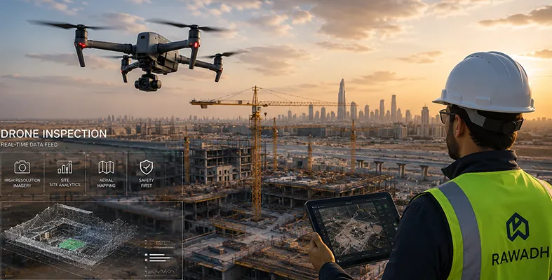
Drone inspection services put a camera where a person shouldn’t have to climb. Rawadh flies drones over bridges, power lines, pipelines, and construction sites to capture the imagery; a manual inspection would take far longer and far more risk to get. It’s a form of industrial drone inspection built on the same principle behind our time-lapse camera work: a clear, dated visual record without putting someone on scaffolding or a rope to get it.
What's Included
- A drone survey of your site or asset, scoped to what you actually need inspected
- High-resolution imagery and video, delivered in a format your team can use directly
- Aerial mapping output for sites where you need more than a photo set, an actual site layout
- A written summary flagging anything the footage shows that's worth a closer look
- Ongoing support if you need repeat flights over the life of a project
Get your site documented in 3 simple steps
From first contact to delivered footage — here’s how Rawadh gets your inspection done.
Get in touch
Email info@rawadh.com or call us with the site, the asset, and what you need documented.
We plan the flight
Our team scopes the site, checks access and airspace requirements, and schedules the inspection.
You get the footage
Imagery, video, and mapping output — delivered, with a summary of anything worth flagging.
Drone services built for the work that needs them
From site surveys to infrastructure inspections, Rawadh gets you the view you can’t get from the ground.
Construction Site Surveys
Regular flights over an active site give you a top-down view that a ground-level camera can’t, useful for tracking overall site layout, material staging, and progress across a footprint too large to walk in one pass.
Infrastructure Inspections
Bridges, power lines, pipelines, and anything else that’s expensive or dangerous to inspect manually. A drone gets close enough for a detailed look without scaffolding, rope access, or a shutdown.
Aerial Photography & Mapping
High-resolution stills and video for documentation or marketing, plus mapping output for sites where you need an accurate aerial layout, not just a picture.
Who This Is For
- Contractors who need a site-wide view that ground-level cameras and site visits can't give them
- Infrastructure owners and operators who need bridges, pipelines, or power lines inspected without a shutdown or manual climb
- Developers and consultants who need aerial documentation for reporting, marketing, or planning
Why Rawadh
We already run the monitoring side of construction, timelapse cameras, dashboards, and reporting, so a drone survey slots into a workflow you’re already using, instead of being a one-off vendor you have to manage separately.
Where We've Worked
Rawadh has documented projects across major Saudi developments, including work tied to NEOM and Qiddiya. If you’d like specific drone-inspection project names for this page, let me know which of your listed projects actually used drone survey work so I can add them accurately rather than assume.
Where This Service Is Available
We run drone inspections across Saudi Arabia and the UAE, with the service also extended into the UK and Germany.
Any Question? Find Them Here.
What are drone inspection services?
A form of industrial drone inspection: using a drone to capture imagery and video of a site or structure, instead of sending someone up scaffolding, a rope, or a lift to get the same view.
What can a drone inspect that a fixed camera can't?
Anything tall, remote, or awkward to reach: bridges, power lines, pipelines, rooftops, or a construction site too large to cover from one ground-level angle.
Do you provide mapping, or just photos and video?
Both. We deliver standard imagery and video, plus aerial mapping output for sites where you need an accurate layout, not just a picture.
How does this connect to Rawadh's other monitoring services?
It sits alongside our timelapse camera and construction monitoring work, so aerial data and ground-level monitoring end up in the same place instead of two separate systems.
Where is this service available?
Saudi Arabia and the UAE, with the service also extended into the UK and Germany.
Services
Any Questions? Let’s talk
- Al Haram Project
- Mall of Saudi Project
- Saudi Railway
- NEOM Office Project
- Qiddiya Road Project